Explore North Albany Parks and Trails Near Albany
May 14, 2026
May 14, 2026
Looking for an easy way to picture daily life in Albany? One of the best places to start is outside. From riverfront paths near downtown to quieter green spaces in South Albany and North Albany, the local park and trail system gives you a practical feel for how people walk, unwind, and spend time close to home. If you are getting to know the area, this guide will help you see which outdoor spots may fit your routine best. Let’s dive in.
Albany’s outdoor story is not centered on just one destination. The city manages more than 887 acres of parkland, walking trails, and open spaces, and it describes a system with a neighborhood or community park in nearly every neighborhood zone.
That matters if you are comparing areas of town. Instead of relying on one major recreation hub, Albany offers a mix of playgrounds, picnic shelters, sports fields, open grassy areas, trails, multi-use paths, and natural areas that support everyday use.
For buyers, that can make a real difference in how a neighborhood feels. A short paved loop, a nearby fishing spot, or a path that works for an evening walk can shape your day-to-day experience as much as commute time or home style.
If you enjoy being near the water, downtown Albany offers one of the clearest examples of connected outdoor access. The city’s waterfront planning focuses on reconnecting downtown with the Willamette and Calapooia rivers through better crossings, sidewalks, park improvements, and trail habitat work.
That long-term vision shows up in the riverfront itself. The Willamette River Greenway is intended to preserve physical and visual access to the river while supporting parks, trails, and bike and pedestrian paths along the bank.
Monteith Riverpark is Albany’s key downtown riverfront park. According to the city’s comprehensive plan, it stretches across 12 blocks along the Willamette waterfront and includes picnicking, boat moorage, a shelter pavilion, bicycle and pedestrian paths, river viewpoints, and a concert stage.
The waterfront project adds even more everyday appeal. Planned and recent improvements include park lighting, a safer playground, a splash pad, accessible seating, and habitat work along the Dave Clark Trail.
In summer, Monteith Riverpark also serves as a gathering place for community events like River Rhythms. If you like the idea of a riverfront setting with activity nearby, this part of Albany is worth a close look.
The Dave Clark Trail is one of the most useful trails to know if you want a paved path near the river. The city describes it as a 1.5-mile one-way trail along the south side of the Willamette River from Monteith Park to Bowman Park.
Along the way, it opens onto residential Front Avenue and Geary Street. That makes it easy to picture how the trail connects not just to scenic views, but also to the everyday street network around the riverfront.
For many buyers, this is the kind of feature that helps turn a neighborhood from “nice on paper” into “easy to live in.” You can imagine a morning walk, a bike ride, or a quick trip to the park without needing a big outing.
South Albany stands out for practical, neighborhood-scale recreation. The South Albany Area Plan calls for a walkable community with pedestrian-friendly streets, a clearly defined network of blocks and pedestrian ways, and a strong trail system.
That framework helps explain why South Albany often feels especially easy to describe in real-life terms. If you want stroller walks, after-school park time, short paved loops, or quick access to open space, this area offers several strong options.
Waverly Park is one of South Albany’s most versatile outdoor spots. It includes fishing, a lake, restrooms, and seasonal paddleboat and kayak rentals, with a lake loop of about 0.70 miles.
That combination works well for buyers who want a simple outing close to home. It is easy to picture a short walk around the lake, a relaxed weekend by the water, or a quick stop that does not require a major time commitment.
Nearby, the Cox Creek and Waverly Lake Loop adds shorter trail options ranging from about 0.65 to 1.35 miles. If your ideal routine includes manageable loops rather than long-distance hikes, this part of South Albany deserves attention.
Grand Prairie Park combines several amenities in one place. The city lists a bike path, fishing, a lake or stream, a playground, a shelter, and restrooms.
It also connects naturally to the Periwinkle Creek Trail, which is paved and flat. The trail runs from Grand Prairie Park toward the Albany Boys and Girls Club, with segments up to 3.61 miles round trip.
That makes this area especially easy to match with everyday routines. Whether you want a longer paved walk, room for play time, or a place to get outside after work, this part of South Albany offers flexibility.
Teloh Calapooia Park is another useful stop for neighborhood recreation. It includes a trail and playground, making it a practical option for a quick outdoor break.
From there, the Oak Creek Greenbelt Trail adds a different kind of experience. It is a soft-surface 1.8-mile connection from Teloh Calapooia Park to the Calapooia River and neighborhoods to the north.
The broader South Albany plan also highlights Oak Creek Parkway as a way to provide visual and physical access to open space. If you are drawn to neighborhoods where natural areas are part of the overall layout, South Albany may feel especially appealing.
Timber Linn Memorial Park is one of Albany’s larger park destinations at 100 acres. It includes disc golf, a lake, ball fields, softball fields, shelters, and a paved path of about 1.47 miles.
This park can be a strong fit if you want more than just a small neighborhood green space. It offers room for longer walks, organized recreation, and casual outdoor time in one setting.
For homebuyers, that range matters. A larger destination park nearby can expand your options for weekends and gatherings while still supporting simple weekday use.
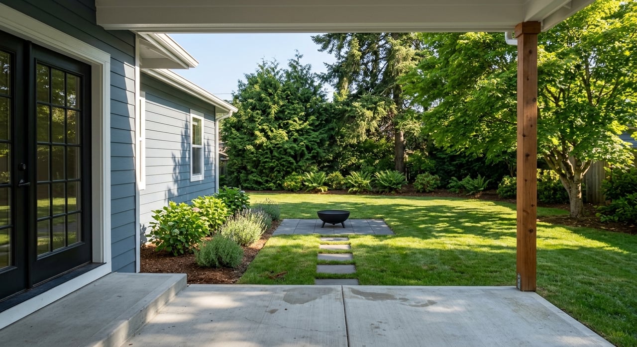
North Albany has a different outdoor feel than South Albany. City planning materials describe growth into farms and wooded hillsides, while local plans emphasize reducing automobile reliance and improving pedestrian and bicycle travel, street connectivity, and public facilities.
In practical terms, North Albany often reads as quieter, more spacious, and closely tied to scenic open space. If you like the idea of river access that feels more low-key than busy, this area has a lot to offer.
Bowman Park, at 300 Geary St NE, is a 26-acre park with a boat ramp, river access, fishing, restrooms, a shelter, and a trail. It is one of the most visible places to experience north-bank access to the Willamette.
For some buyers, that mix of amenities is a major plus. It supports everything from a quick walk to time on the water, which can make the surrounding area feel connected to the river in a very practical way.
Because it also links to the broader riverfront setting, Bowman Park helps show how North Albany blends residential streets with outdoor access. You are not just near the river. In many ways, the river becomes part of the daily landscape.
Takena Landing runs for about 1.5 miles along the Willamette directly across from downtown Albany. The city says it includes an access road, parking lot, boat ramp, day-use areas, and a hiking and nature trail.
This is one of the strongest reference points for North Albany’s more natural, open feel. It offers river access without the same downtown context, which may appeal if you prefer a quieter outdoor setting.
The city’s stewardship work in North Albany also reinforces that character. Ongoing projects include uncovering and saving a historic orchard and planting riparian gardens that support birds, butterflies, and other habitat.
If you are trying to decide which area fits your lifestyle, it helps to think less about which side of town is “better” and more about how you want to use outdoor space.
South Albany often stands out for planned walkability, paved paths, family-friendly park routines, and multiple short loop options. North Albany is often easier to picture as scenic, quieter, and tied closely to river access and open space.
Here is a simple way to frame the difference:
| Area | Best fit for | Notable outdoor features |
|---|---|---|
| South Albany | Daily walks, park routines, short loops | Waverly Park, Grand Prairie Park, Periwinkle Creek Trail, Oak Creek Greenbelt, Timber Linn |
| North Albany | River access, quieter settings, scenic open space | Bowman Park, Takena Landing, connected residential street network |
| Downtown waterfront | Walkable riverfront outings, events, multi-use paths | Monteith Riverpark, Dave Clark Trail, Willamette riverfront |
Parks and trails can help you narrow your search in a more personal way. If you know you want a paved evening walk, fishing nearby, easy river access, or a park that works for regular routines, those details can guide which parts of Albany deserve a closer look.
This is especially helpful if you are relocating or trying to compare neighborhoods from a distance. A home search becomes much clearer when you connect the map to real, day-to-day habits.
With more than 30 years of local experience in the Willamette Valley, Debbie Brand helps buyers and sellers look beyond square footage and see how a property fits the life they want to live. If you want help comparing Albany neighborhoods, riverfront areas, or South Albany and North Albany homes, Debbie Brand can help you make a confident move.
Get assistance in determining current property value, crafting a competitive offer, writing and negotiating a contract, and much more. Contact me today.